Corporate Services
Streamline Operations,
Mitigate Risks,
Ensure Compliance.
Our expertise in surveying, mapping, and geospatial solutions, lets us provide organisations and governments with services that are essential for construction planning, land acquisition, and project feasibility studies.
Our team utilizes cutting-edge technology to deliver reliable, high-quality results that empower informed decision-making.
We’re here to help you build a solid foundation for success.
Cadastral Surveying
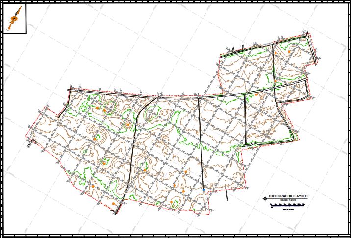
Topographic Surveying
Engineering Surveying
Draughting and Mapping
Photogrammetric Mapping
3D Laser Scanning
Aerial Surveying
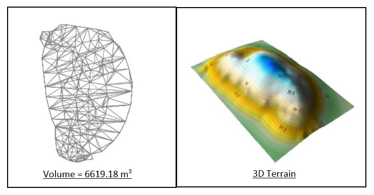
Volumetric and Stockpile Surveying
GIS Design and Implementation
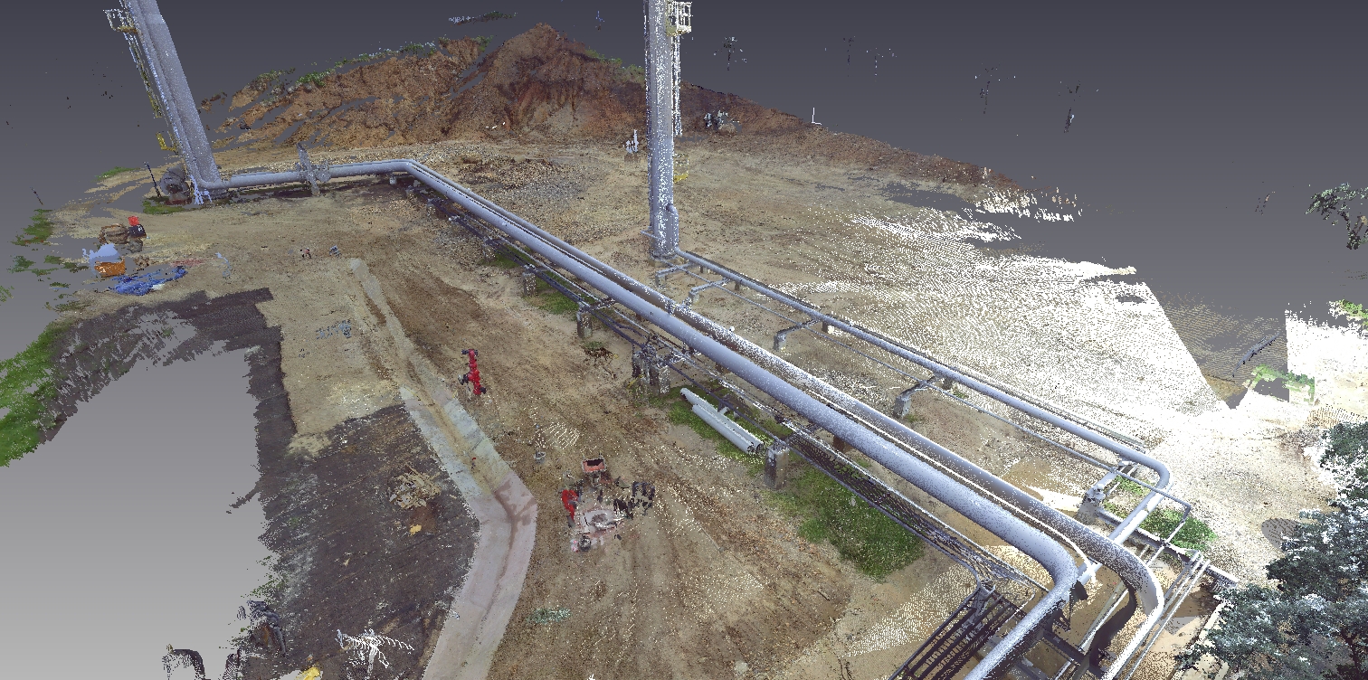
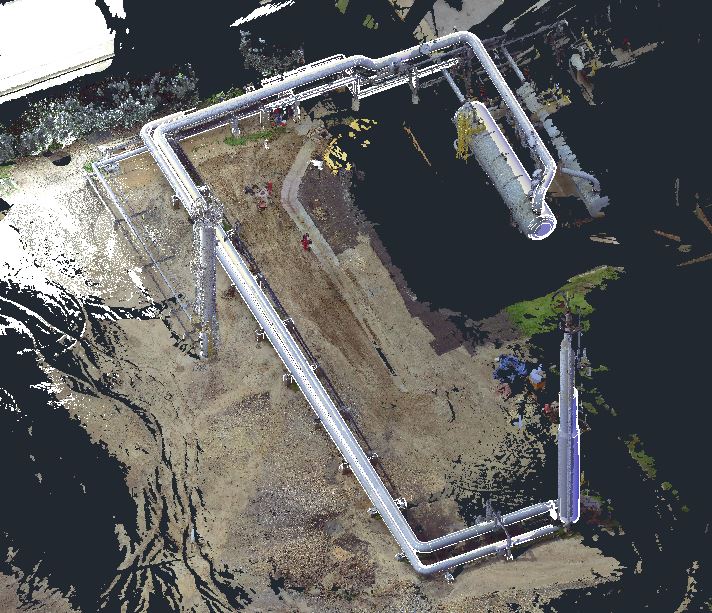
Dimension Control and Pipeline Surveying
Hydrographic Surveying
Subsurface Utility Surveying
Geodetic Surveying
Equipment Sales
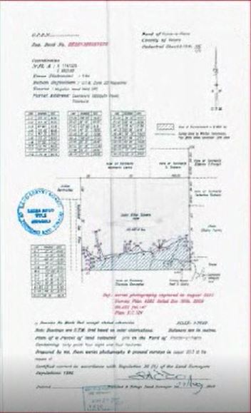
Cadastral Surveying
Our survey team is equipped with licensed and registered land surveyors to assist in the identifying, establishing and redefining property boundaries to determine the limits and extents of parcels, to support the transfer of properties. This includes:
- Subdivisions
- Amalgamations
- Land Acquisitions
We offer this service to the industry and general public alike.
Engineering Surveying
Our team is equipped with licensed and registered engineering surveyors to perform survey works in preparation of, during and after construction or engineering works. Including:
- Feasibility Surveys
- Construction Setting Out
- Verticality Checks
- Settlement Checks
- As-Built Surveys
- Pipe Alignment Calculations
- Bore Placement
- Angle Calculations and Plan Production
- GPS Surveys
Draughting and Mapping Services
For all our services offered, our draughting team is well-trained, professional and equipped to offer a full range of draughting and plan production services. Some of these are:
- General Draughting and Digital Plan Production – draughting services to produce different types of surveying related drawings including cadastral and topographic plans.
- Large Scale Printing and Plotting – printing plotting and reproduction of prepared drawings in colour or black and white at various sizes, especially large format maps.
- Alignment Sheets – generation of alignment sheet for pipeline, utility and engineering applications.
- Analogue to Digital Data Conversion – conversion of paper based maps to the corresponding raster and vector digital images.
- Engineering Draughting & Infrastructure Designs – production of civil and engineering infrastructure drawings.
- Architectural Drawings – architectural services ranging from preparation of house plans, consultancy to full design and project management.
Photogrammetric Mapping
Our team is equipped with a well-trained and professional digital photogrammetrist to execute the acquisition of aerial and terrestrial digital imagery which can be used for topographic mapping, measurement, image analysis, change detection and aerial photographic inspections.
This services includes:
- Photogrammetric Consultancy – analyze and assess both new and archive photographs to identify extents and patterns of occupation, encroachments, vegetation etc. Also photogrammetric reports that can be used as legal evidence.
- Orthophotography – Ortho-rectified images combine the image characteristics of a photograph with the geospatial qualities of a map to create valuable digital ortho-imagery products for feature extraction, GIS base mapping, engineering design, right-of-way mapping, alignment sheets, etc.
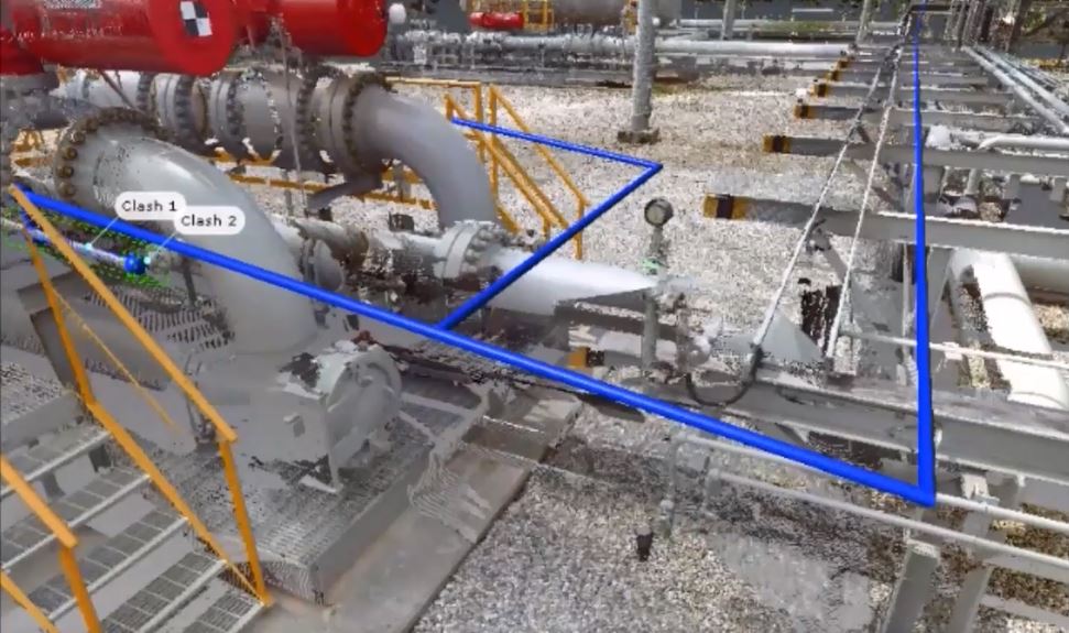
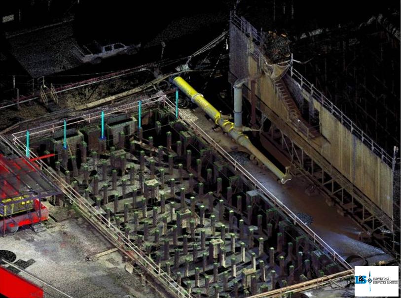
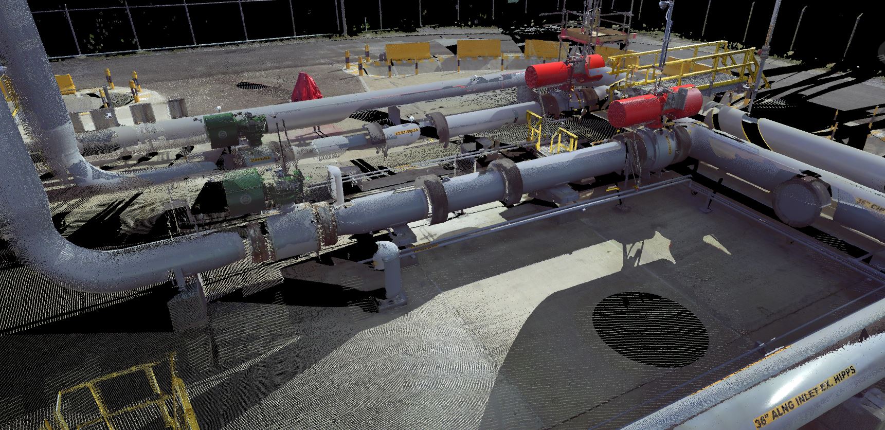
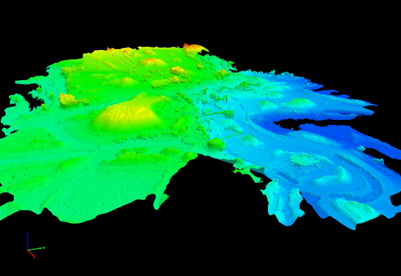
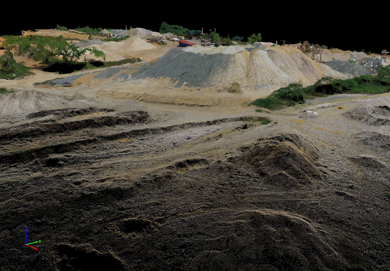
3D Laser Scanning
This service includes LiDAR and terrestrial 3D laser scanning to determine the precise elevation and geospatial location of terrestrial objects and features. From this form of data capture:
- Three-dimensional topographic plans,
- Highly accurate surveys of both surface terrain elements and man-made structures
- 3D models
Also another reliable and accurate data capture method for BIM, Digital Twin and Asset Management.
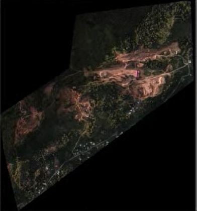
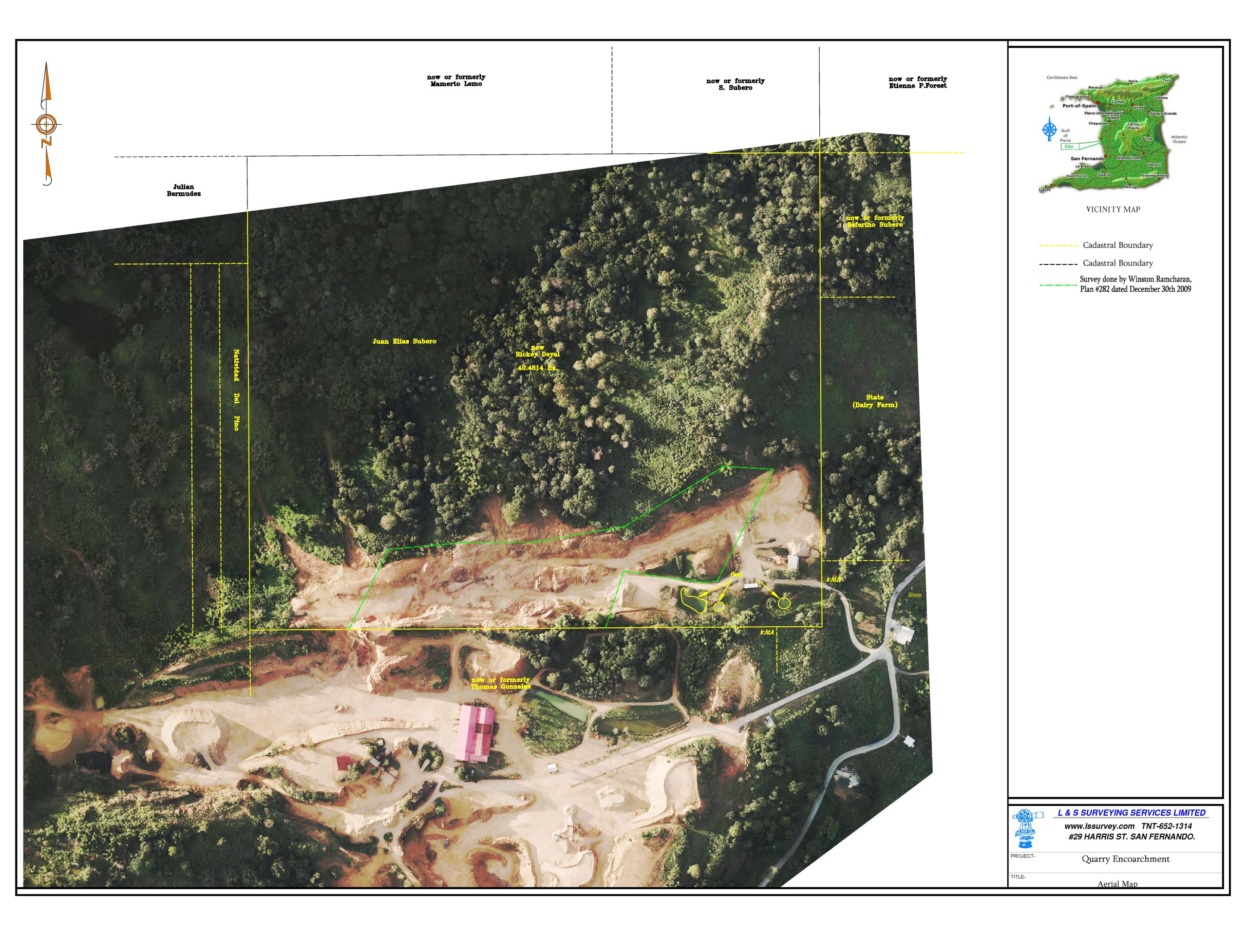
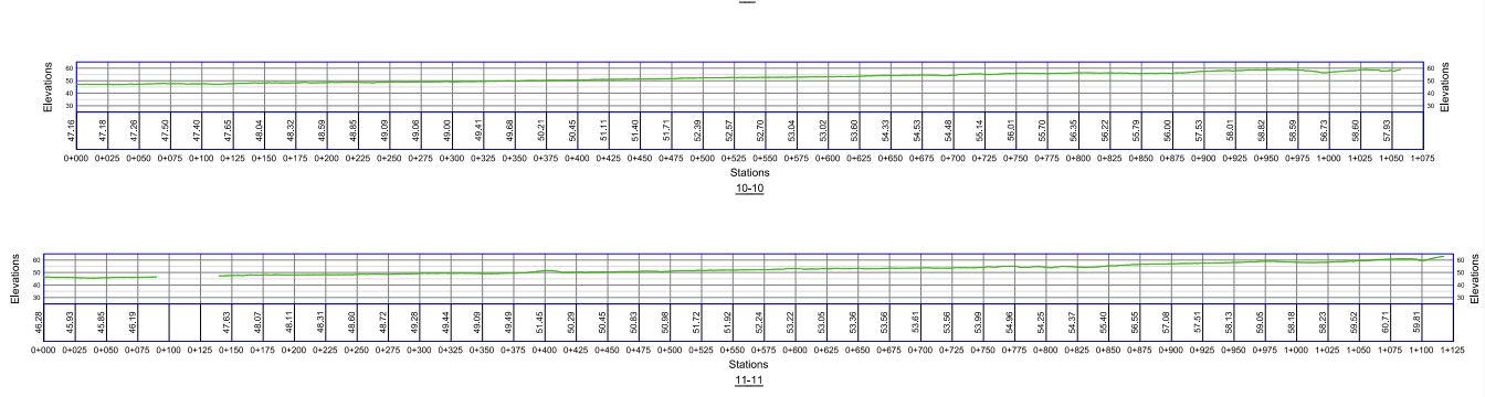
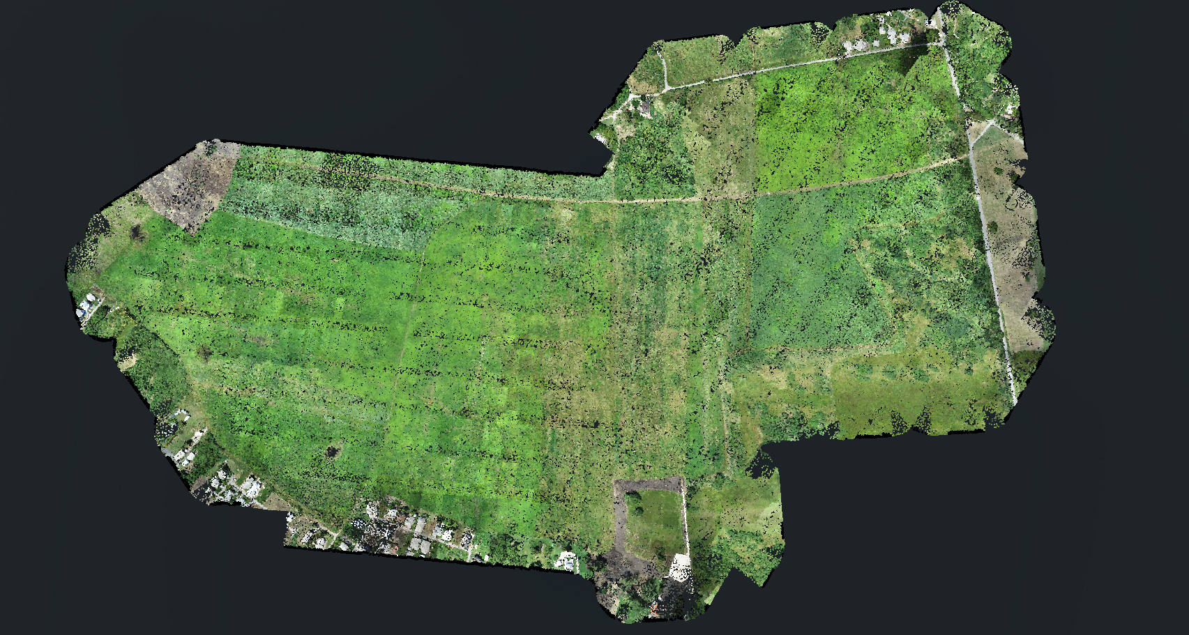
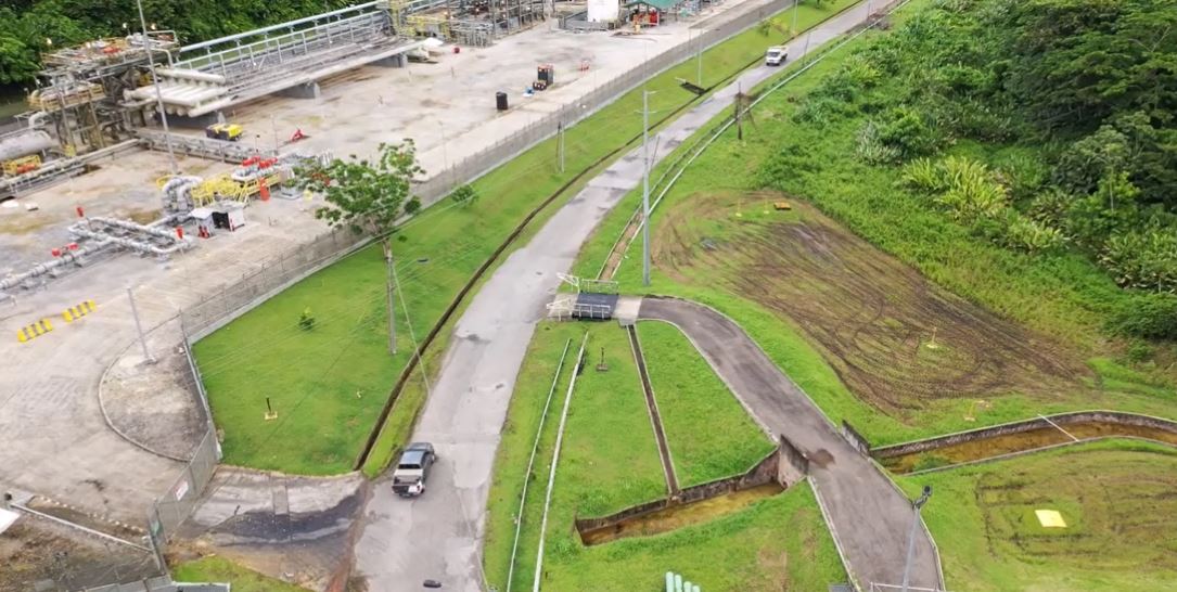
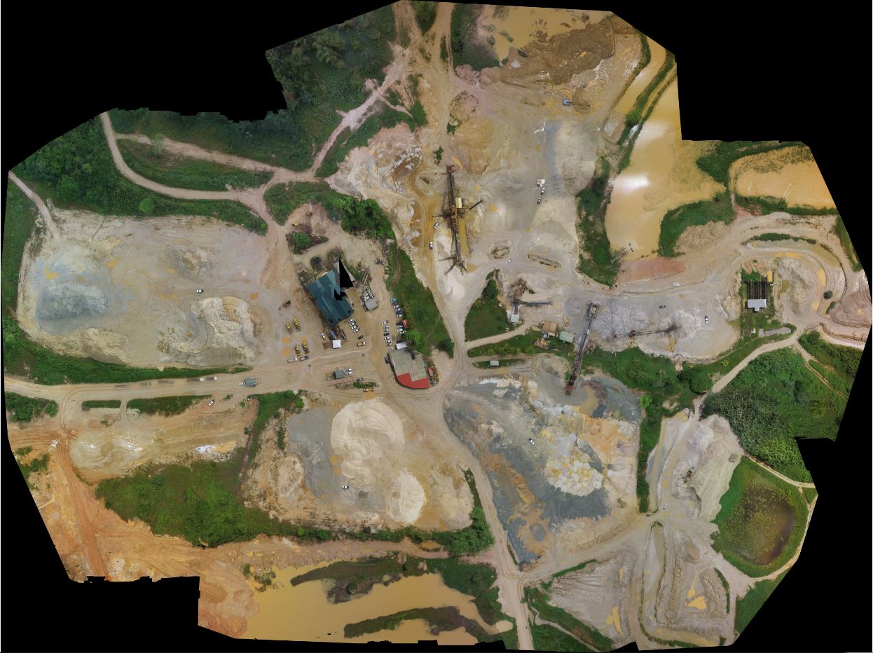
Aerial Surveying
We provide state of the art aerial mapping solutions via UAV technology. Geospatial data capture capabilities range from imagery to LiDAR employing survey best practices to maintain survey grade accuracies. Performed and analyzed by professionals, guaranteeing savings in cost, time and value added data. Some of the services include:
- Land/Environmental Monitoring
- Utility Monitoring
- Topographic surveys (also elevations, contours)
- Feature Extraction
- GIS base mapping
- Inspections of right of ways, quarries and industrial plants
GIS Designs and Implementation
Provision of enhanced services to private, public and government organizations. Some of the service offerings include:
- Topographic data collection and Surveying
- Information, Project and Asset Management
- Decision support systems development
- Enterprise GIS roll-out
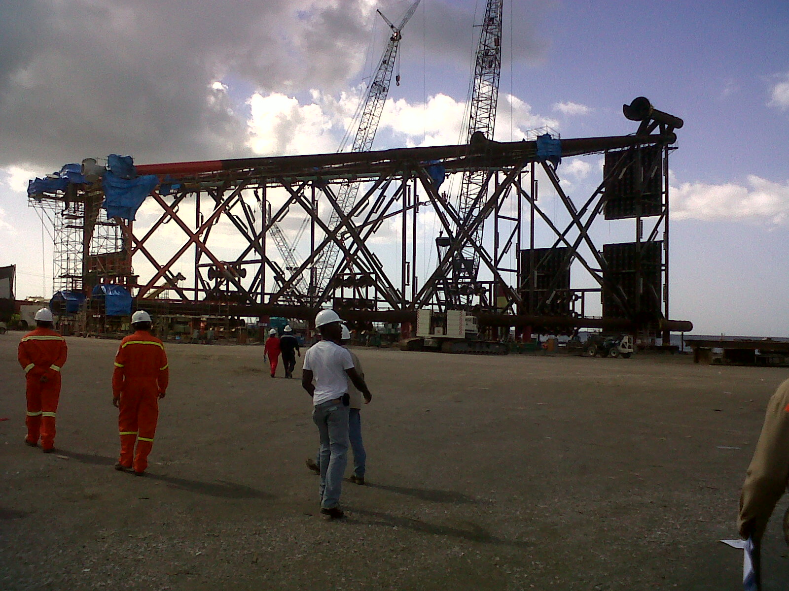
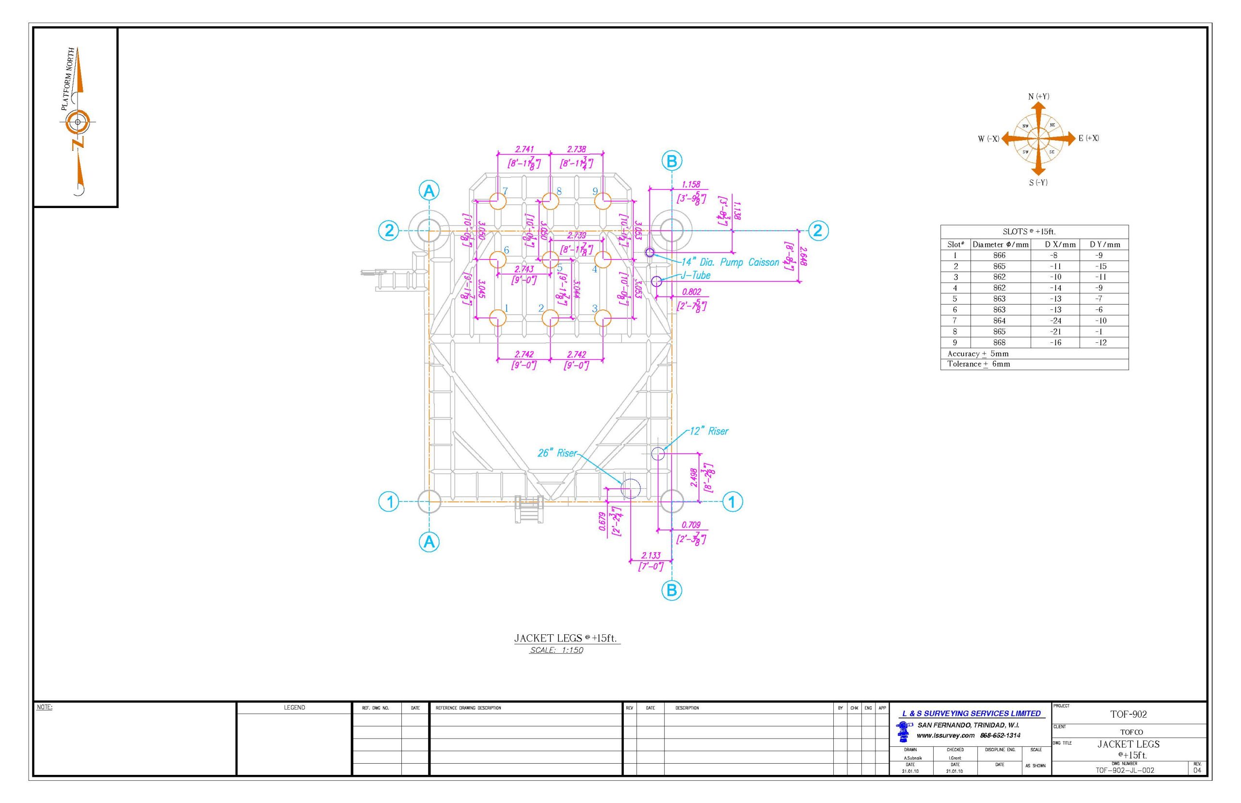
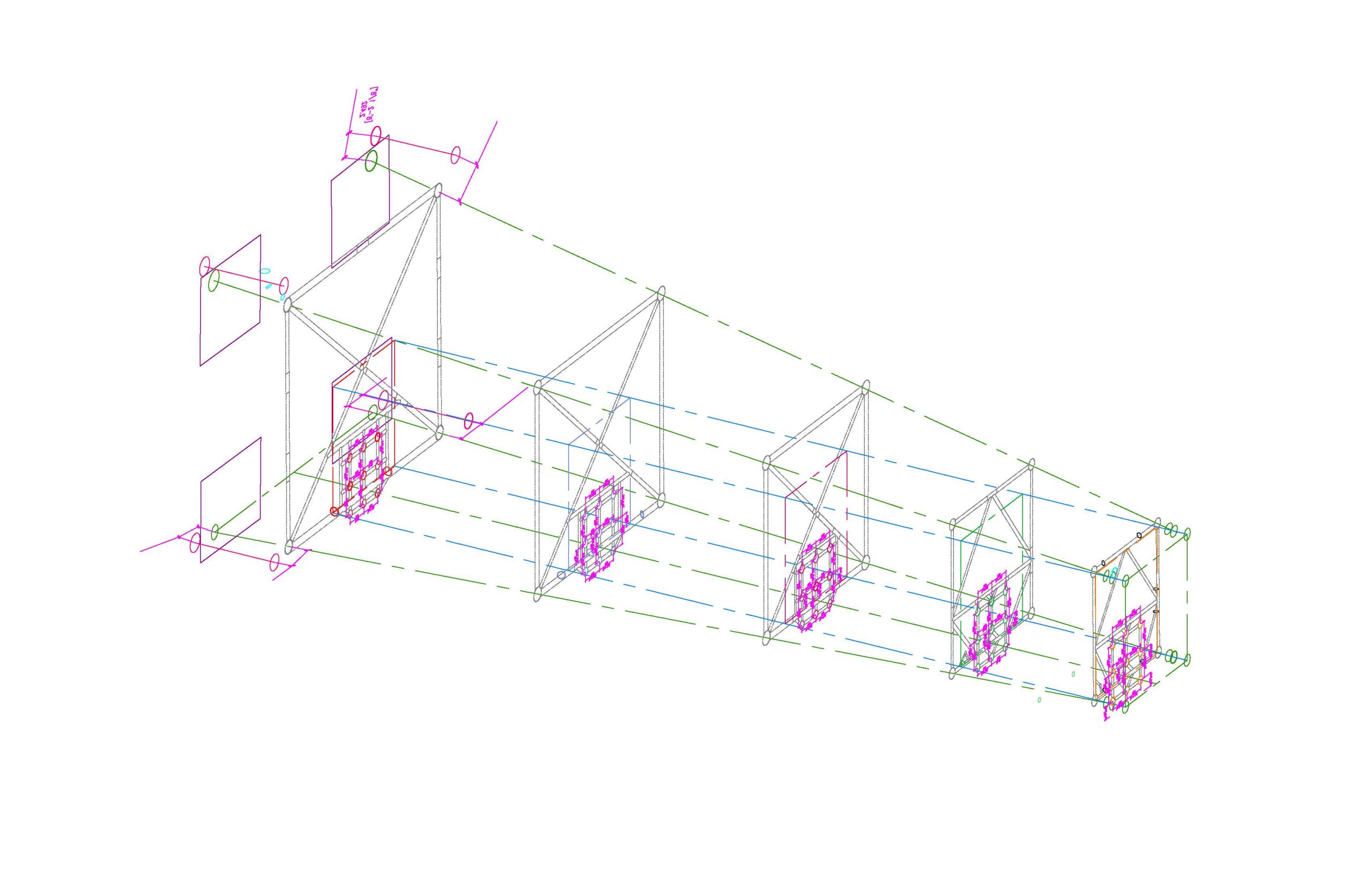
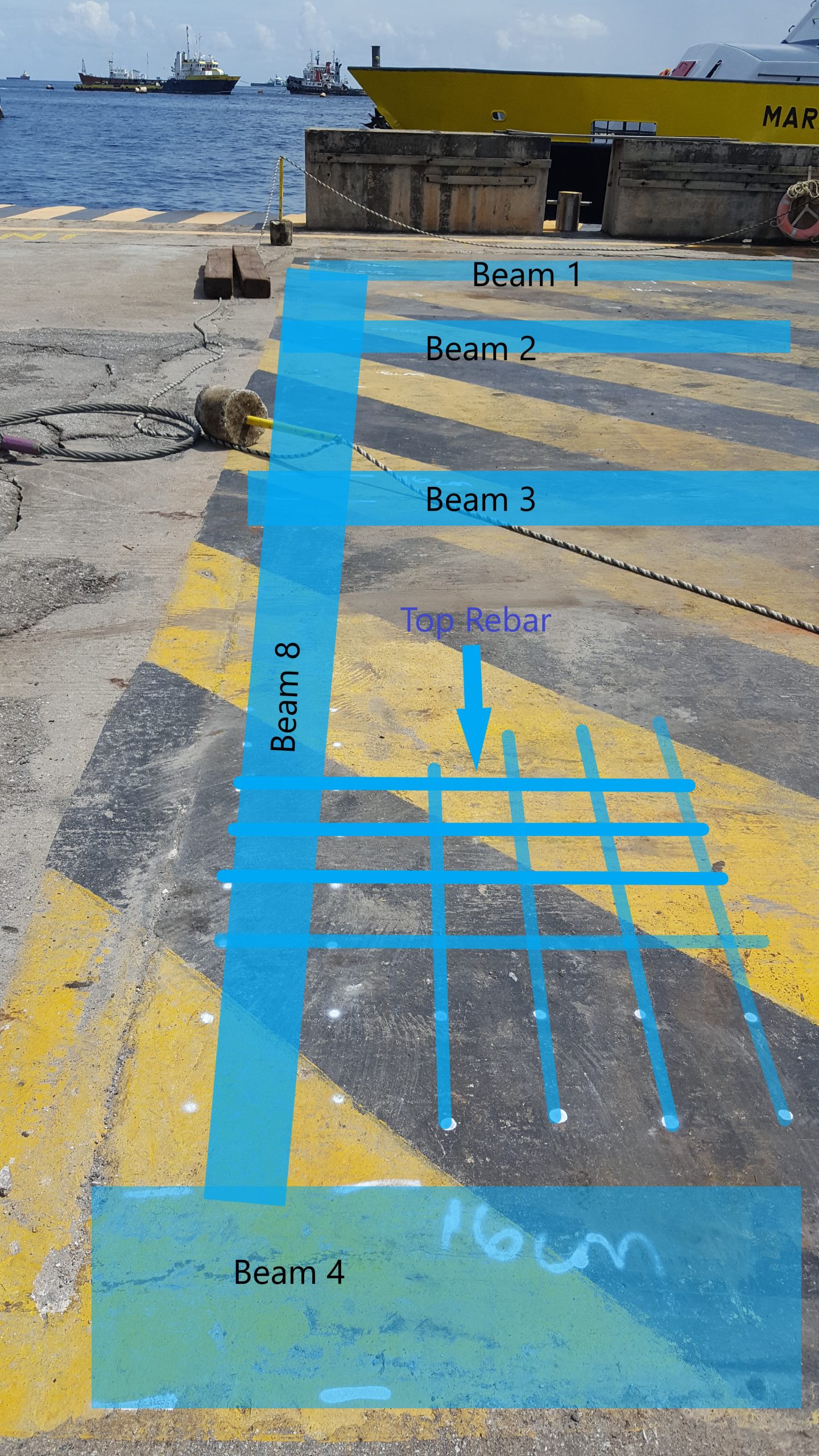
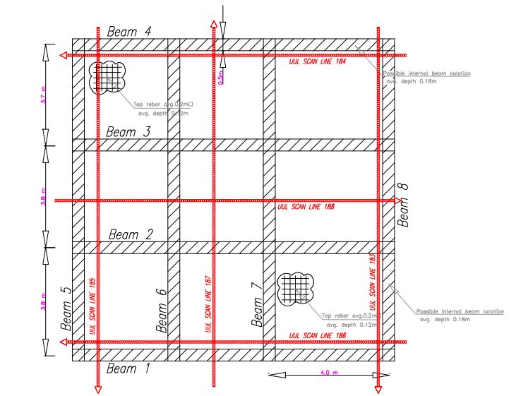
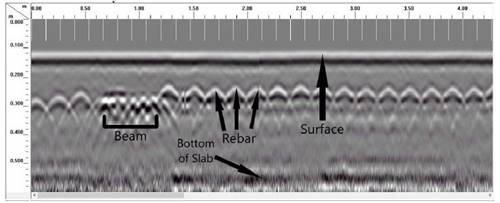
Dimension Control & Pipeline Surveys
L&S is equipped to offer services specific to the construction and pipeline industry. This service obtains dimensions from engineering structures for connecting and linking infrastructure as to perform quality checks on built features. This includes:
- Dimension Control Surveys
- Design of spool pieces for precise fit-ups
- Pipeline route selection and analysis
- Pre-lay alignment surveys
- Construction alignment surveys
- As-built and re-pinning surveys
Hydrographic Surveying
L&S offers underwater mapping to determine water depths, bottom topography, heights and times of tides, water stages and the location of natural and man-made objects for the purpose of navigation, environmental protection and subaqueous construction. The production of bathymetric charts and support for offshore and marine exploration and construction is also offered.
Some of the services are:
- Port Surveys
- River Engineering Surveys
- Wetlands surveys
- Single beam bathymetric surveys
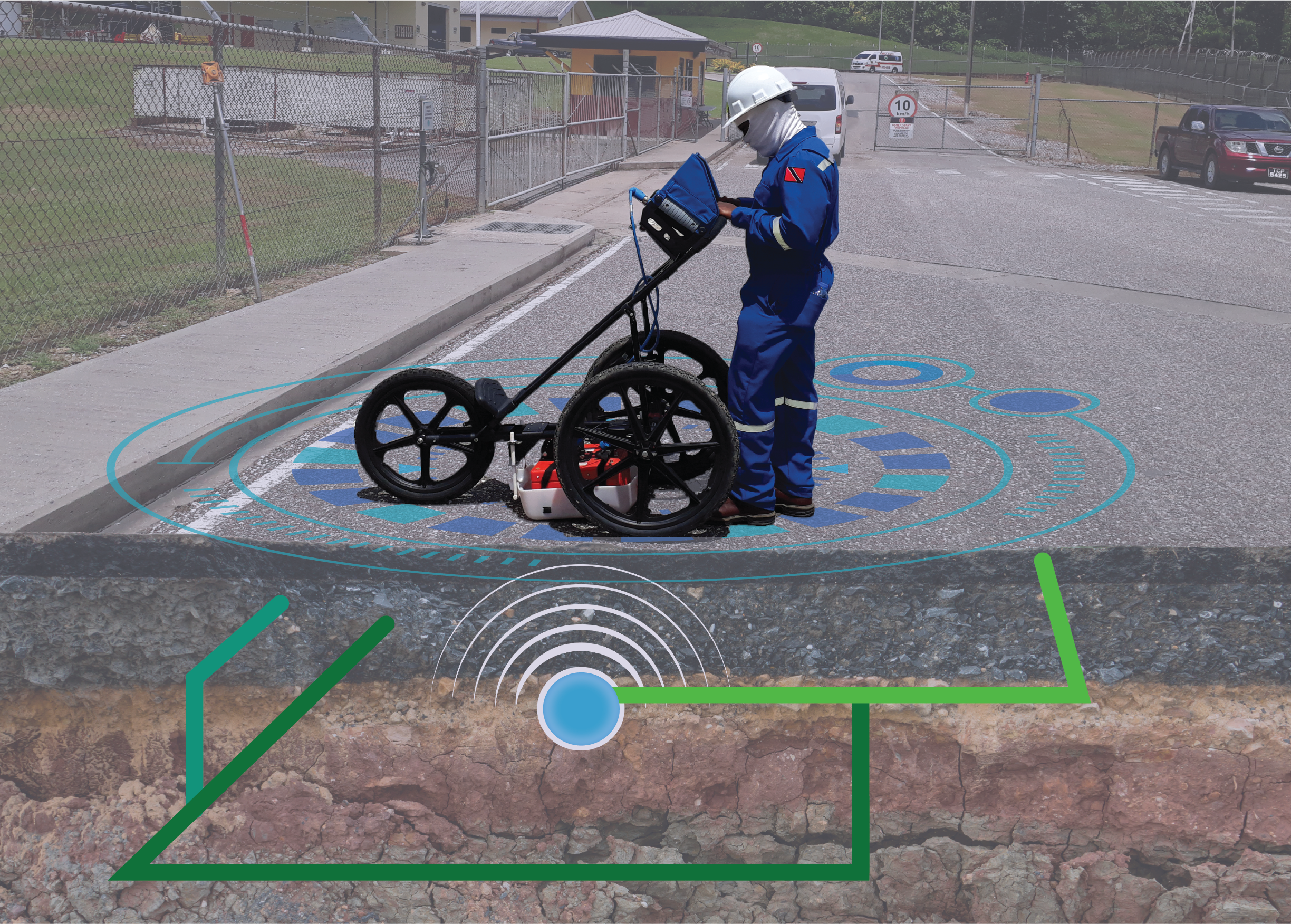
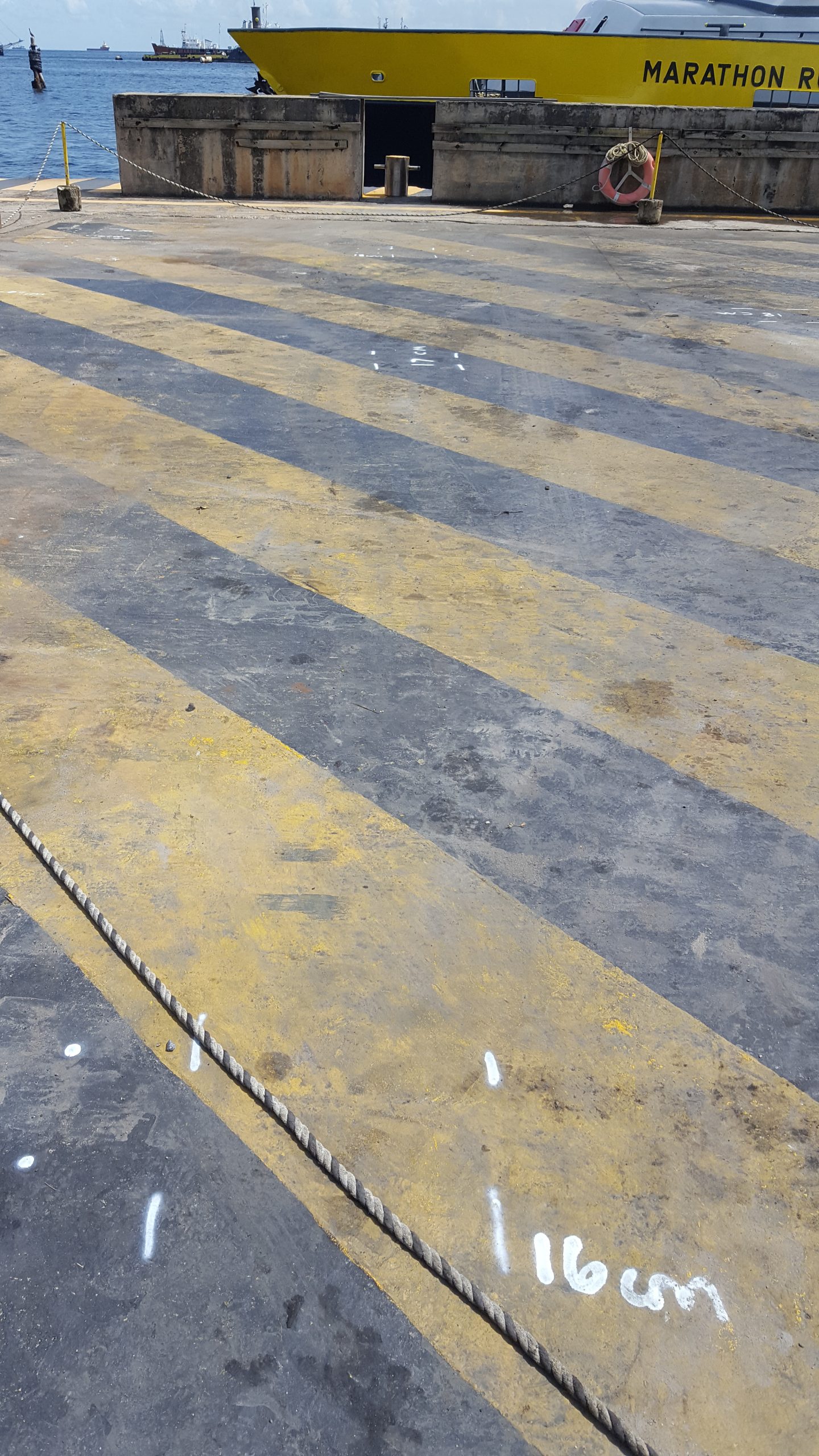
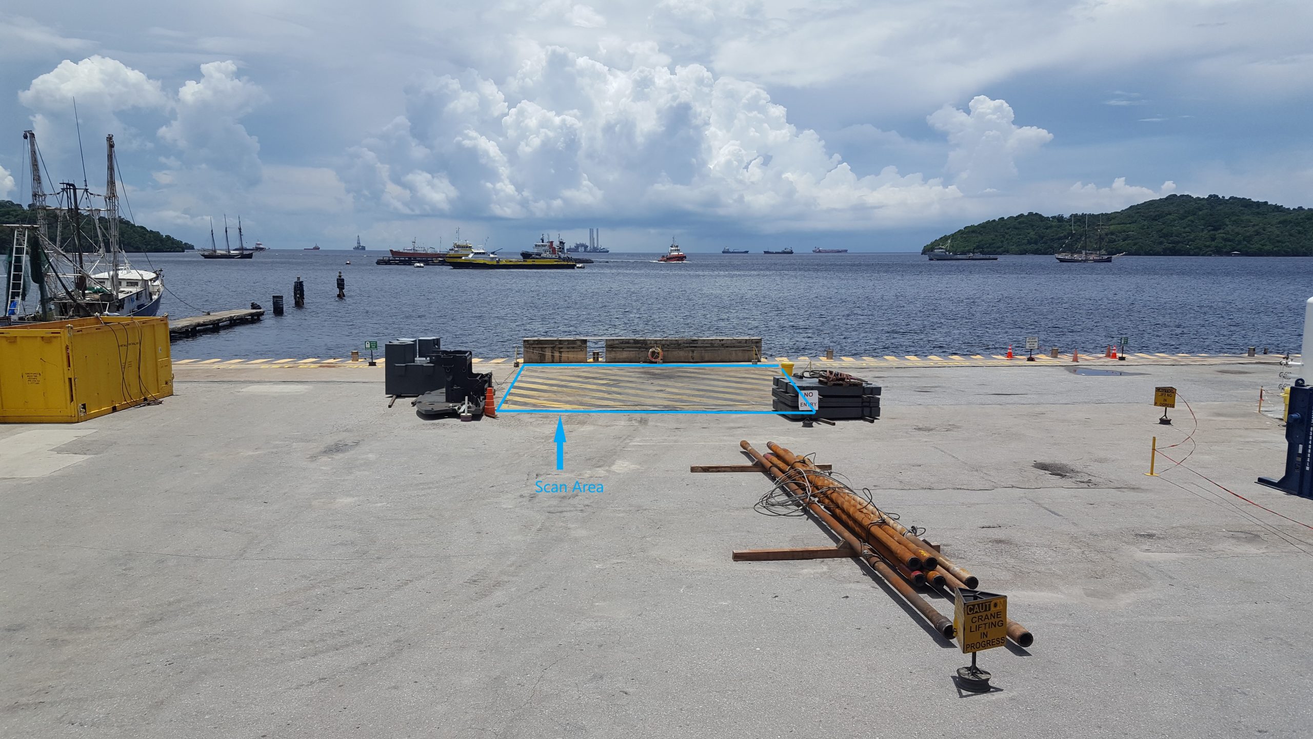
Subsurface Utility Location (Underground Utility Detection)
L&S provides a full service of non-destructive surveys to locate underground features which can also be done prior excavation works to determine position and depth. This service offers:
- Underground Utility Location – For e.g. location of metallic and non-metallic features, utility network infrastructure in concrete floors and walls, underground cavities, obstructions and voids, etc.
- Above Ground Demarcation – installation of appropriate above ground markers for the underground feature/utility position
- Record Preparation – production of maps of the underground features with depth for easy location when required.
Geodetic Surveys
L&S offers large scale surveys which provide coordinates, locations and accurate and rapid data collections through the use of GPS/GNSS technology. Some includes:
- Topographic surveys
- Cadastral surveys
- Control surveys
- Hydrographic surveys
- Engineering surveys
Sales
L&S offers sales in surveying consumables and equipment to assist in various surveying and mapping projects.
We are also the authorised distributor for Rhino Marking & Protection Systems.